


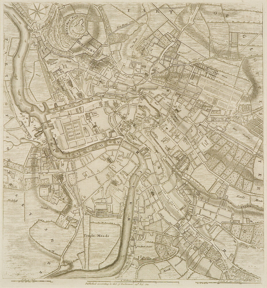


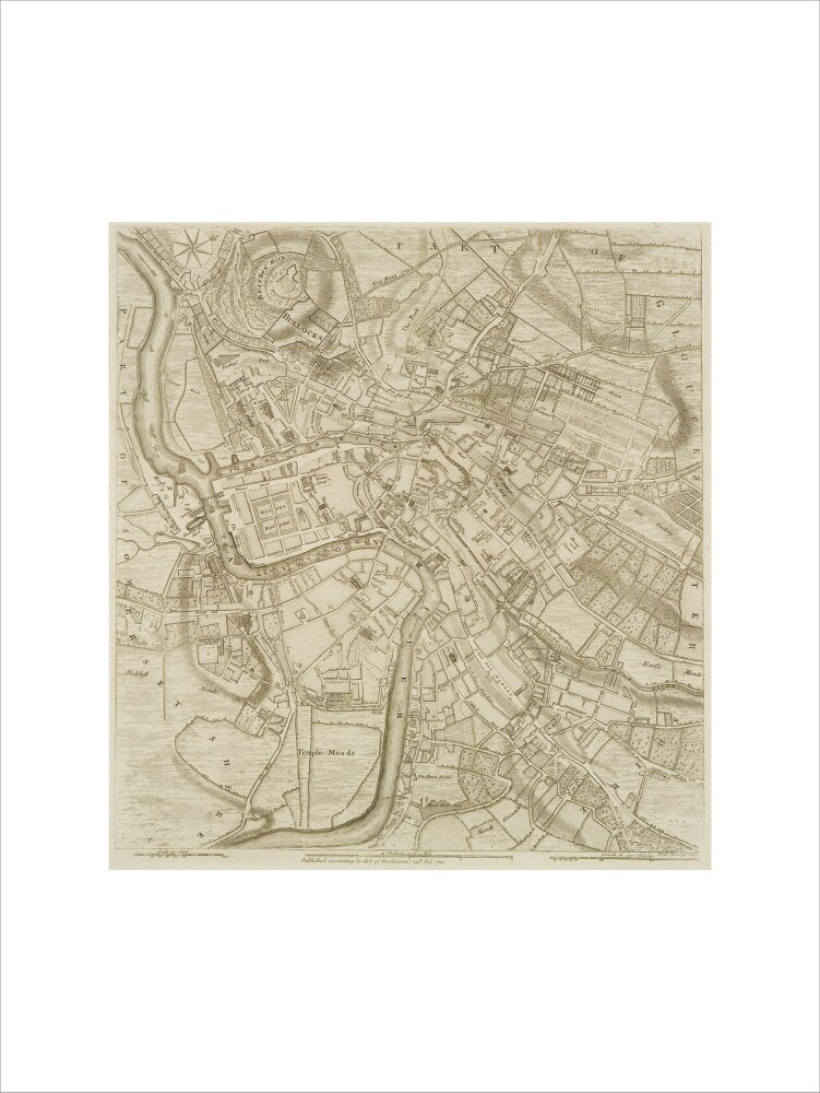
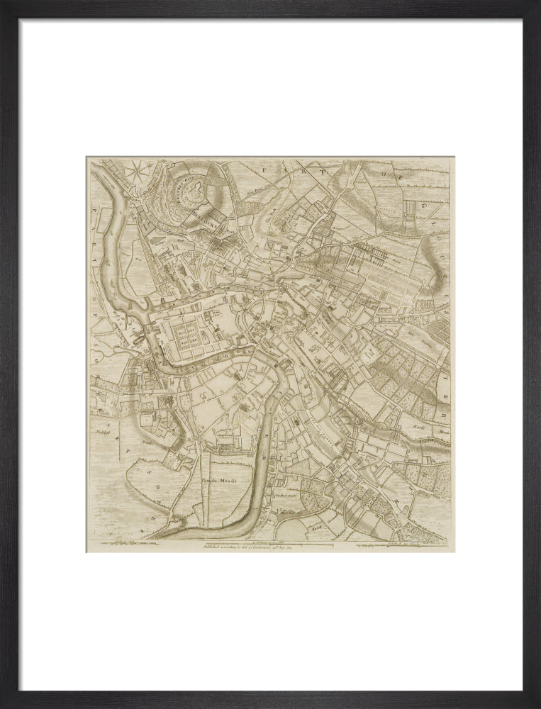

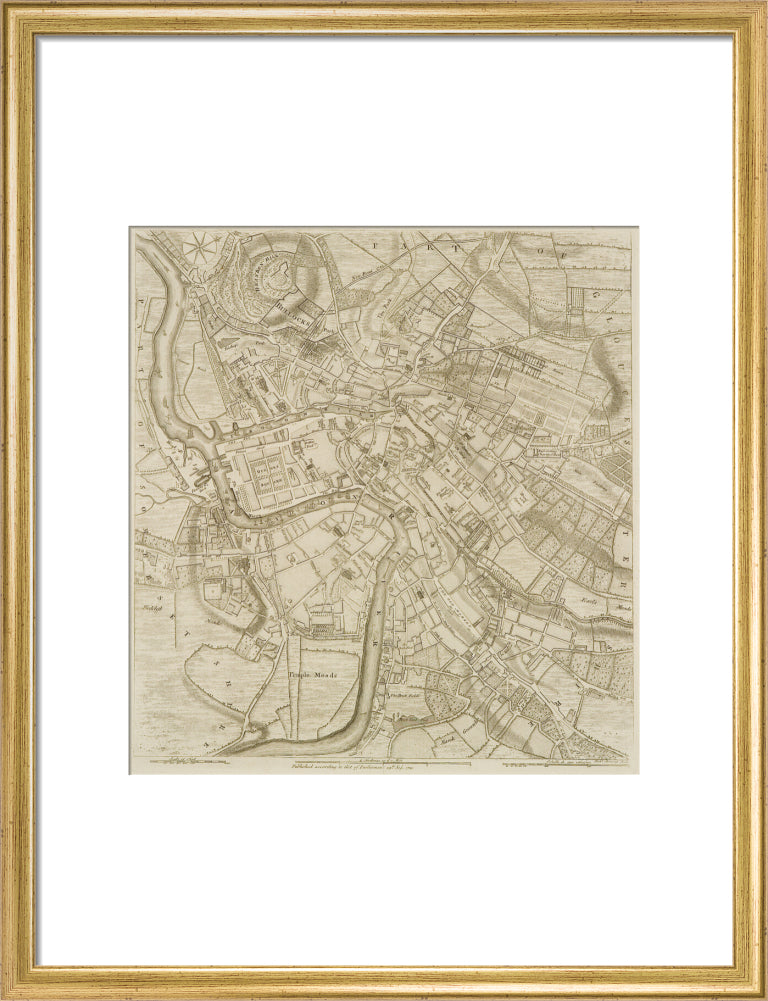


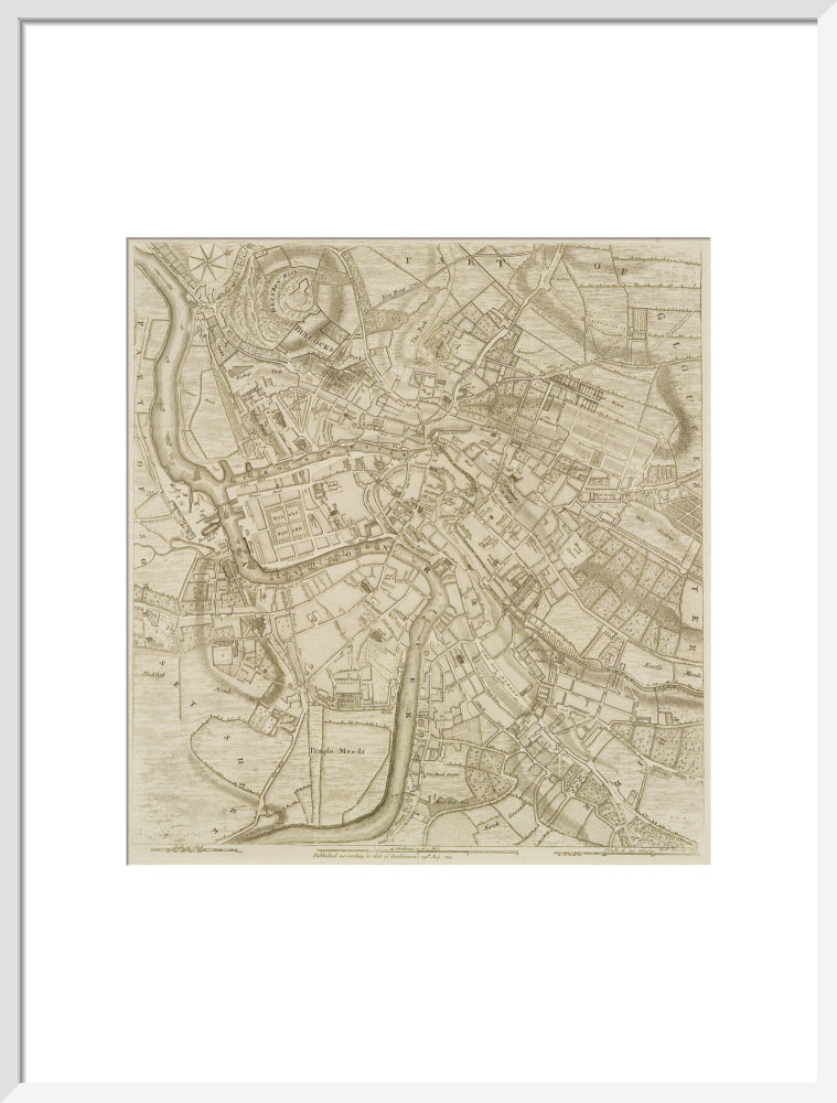
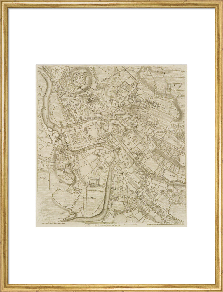
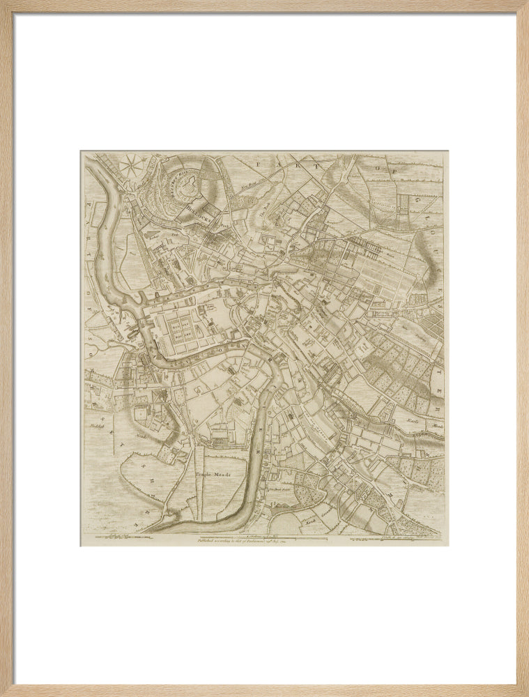
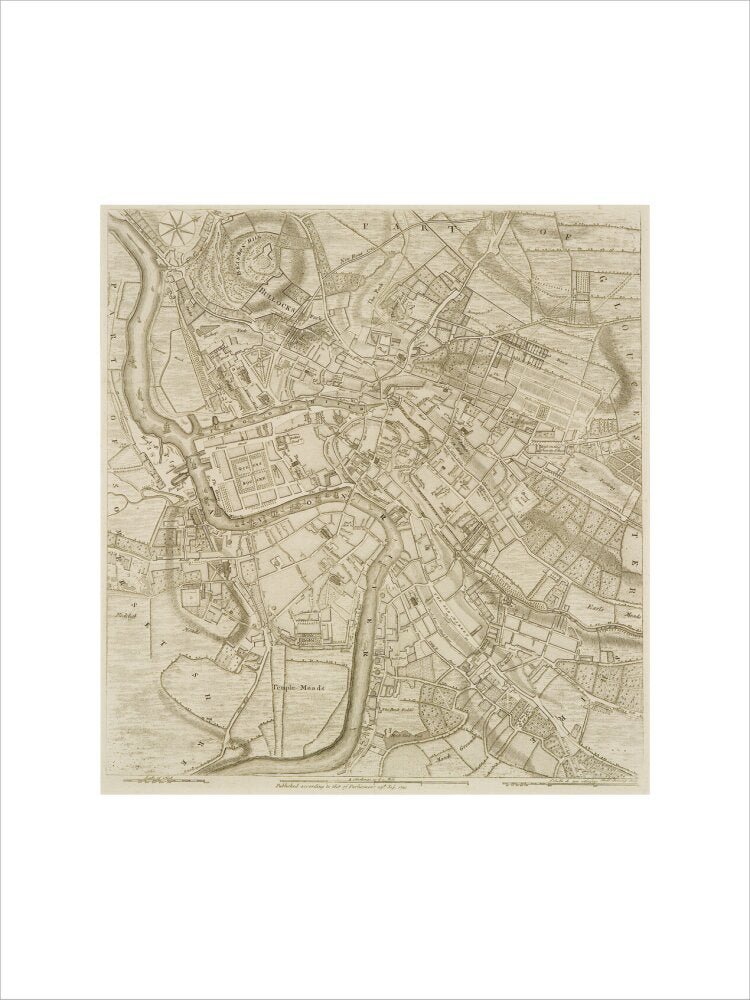


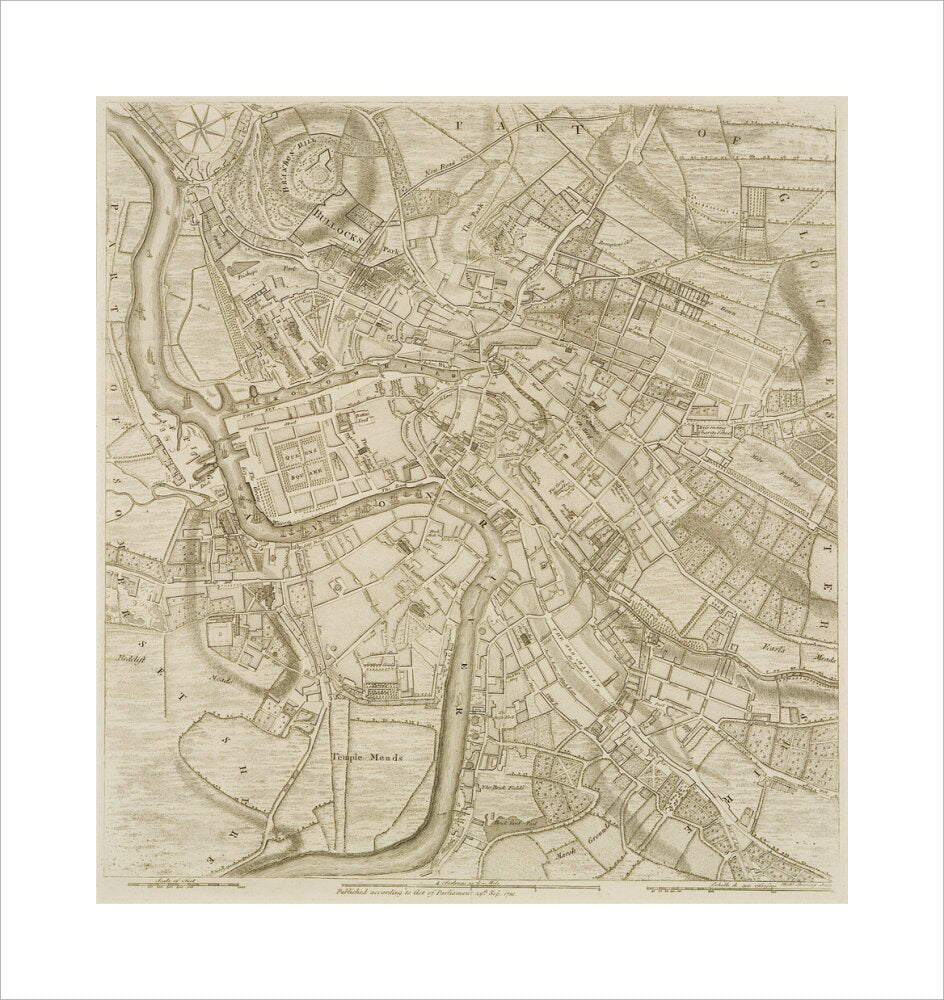
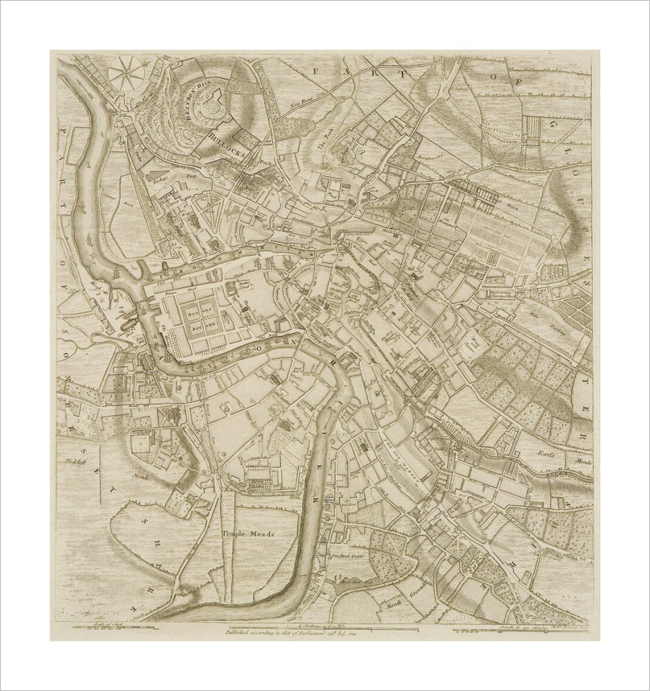


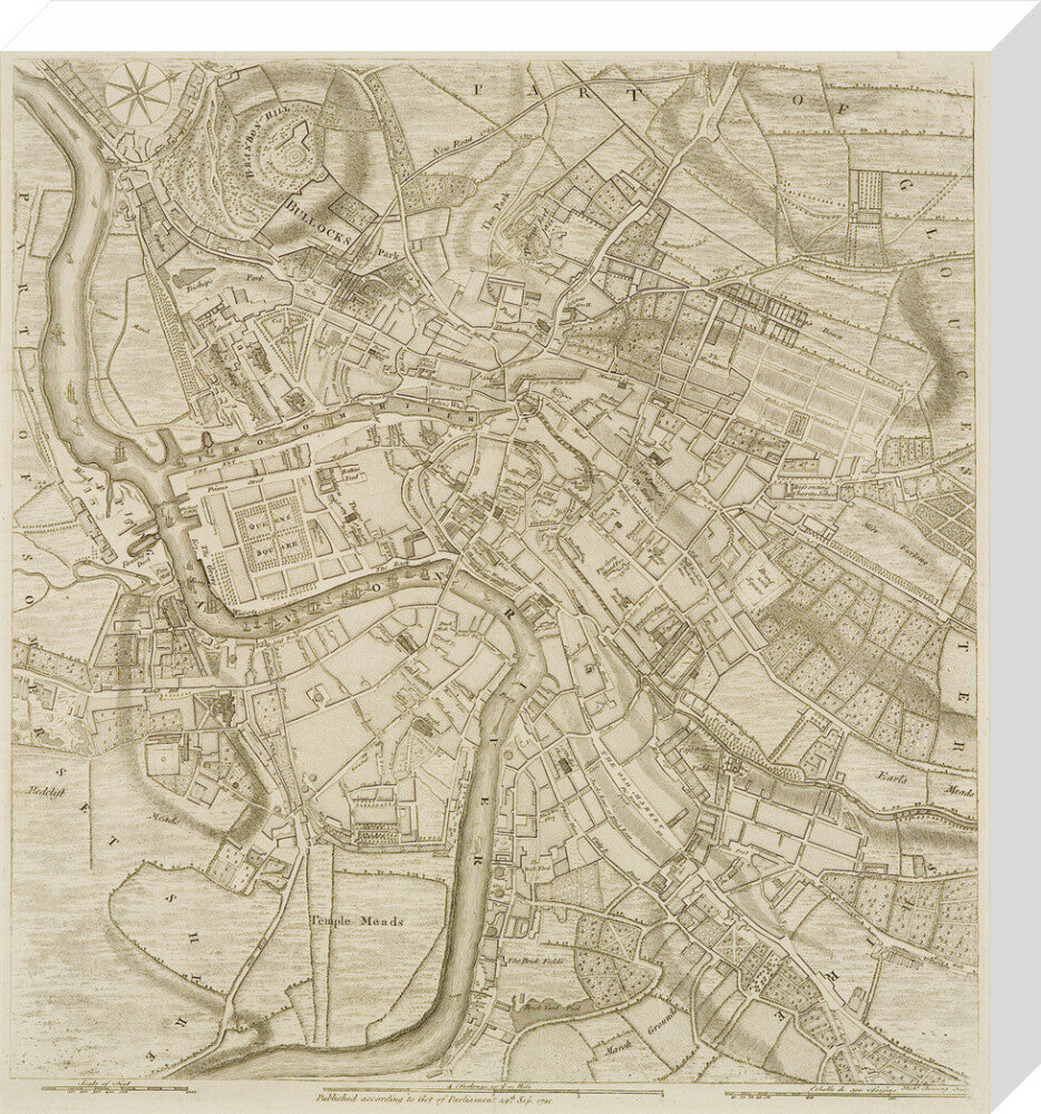

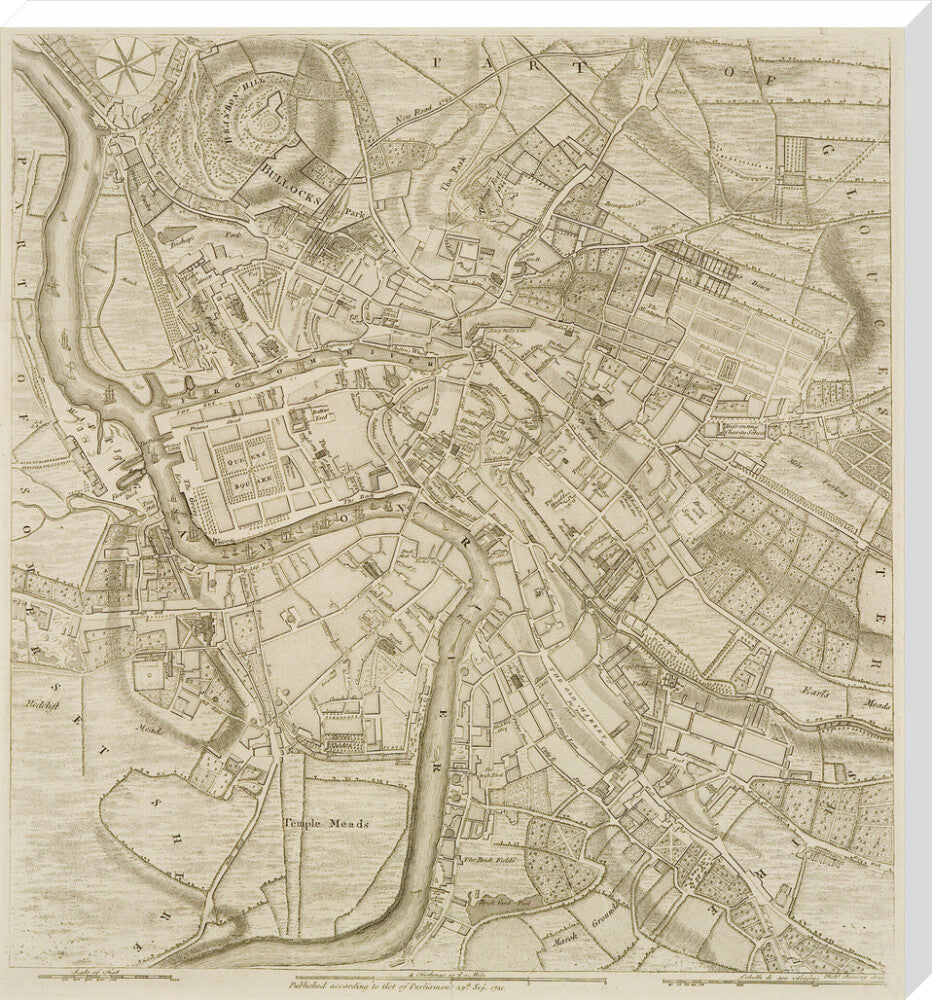
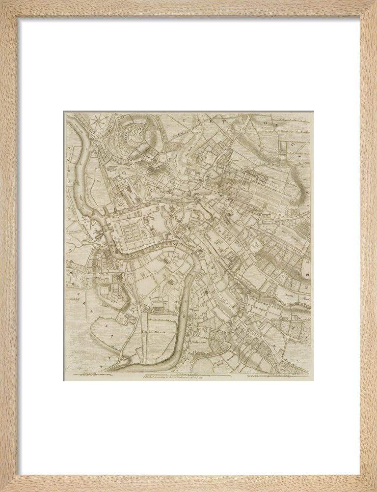
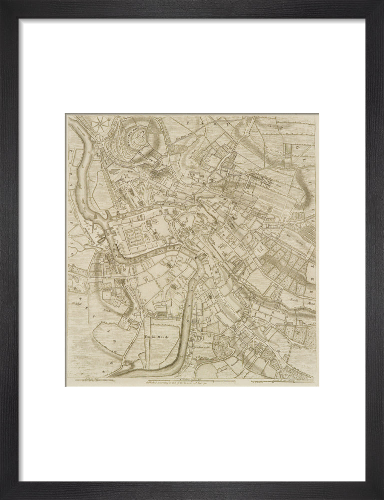
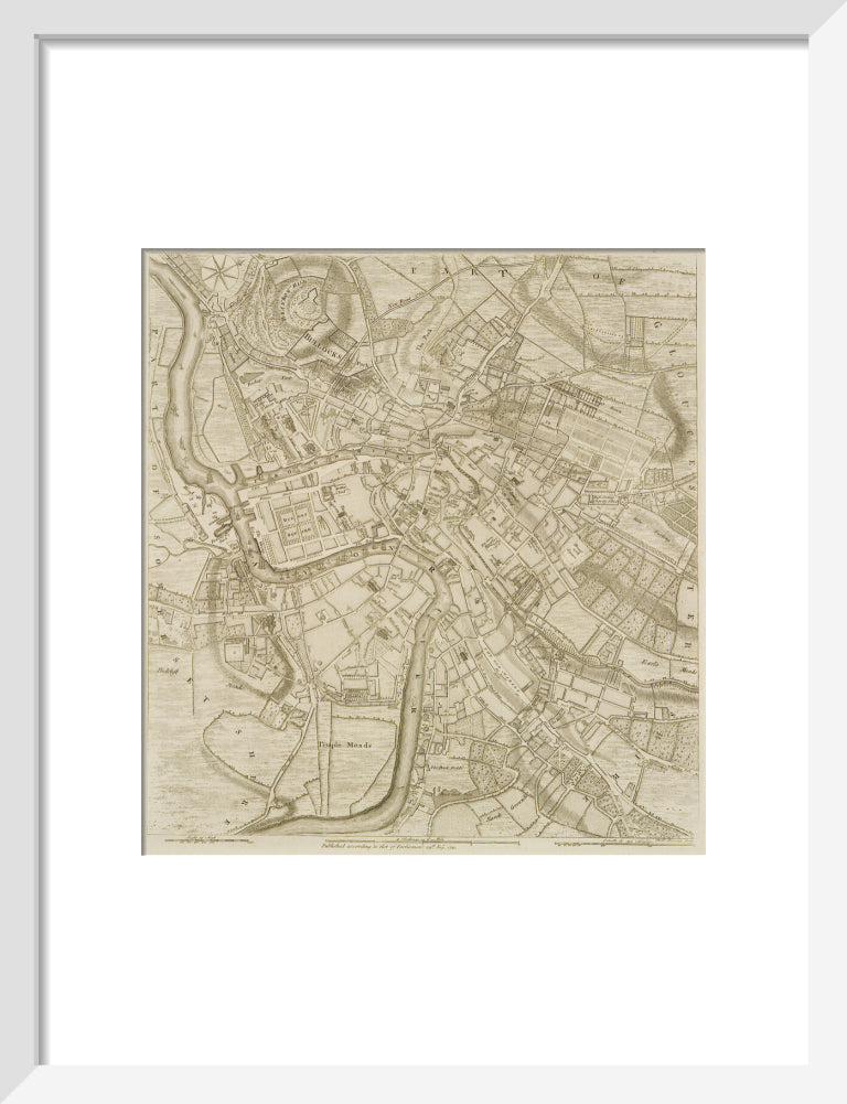
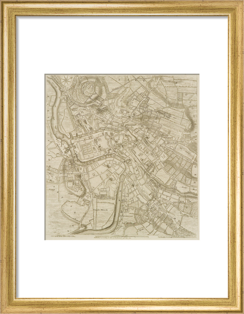
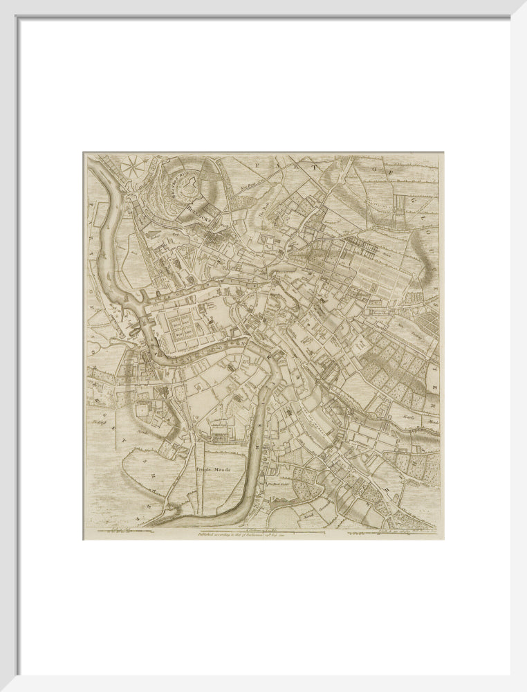
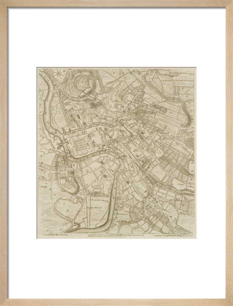
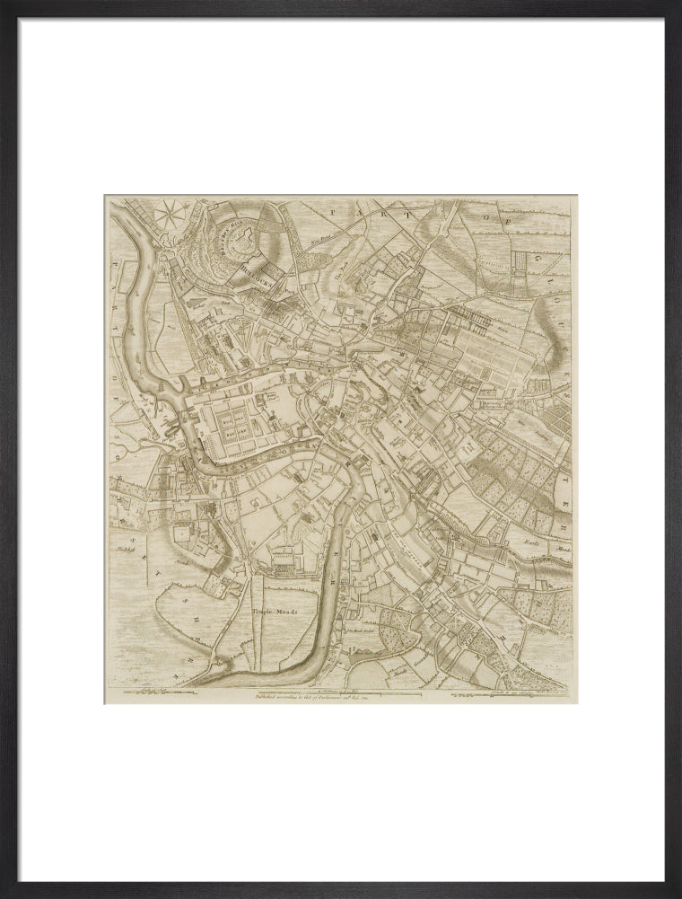
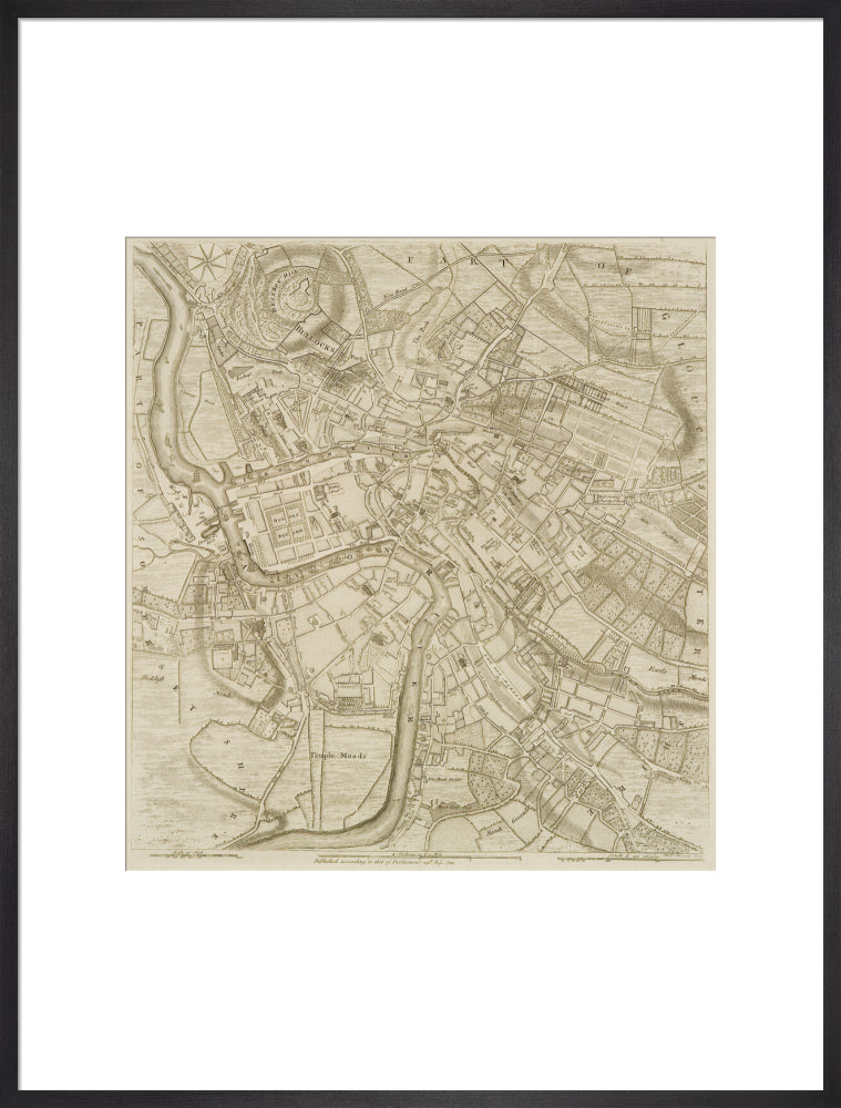
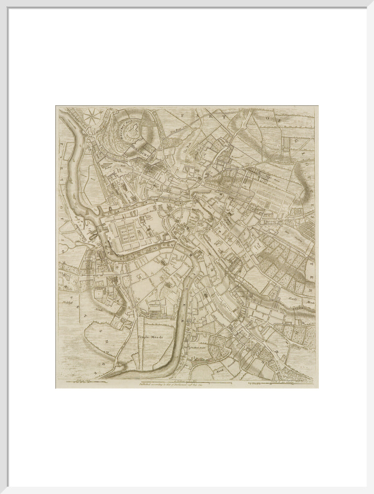
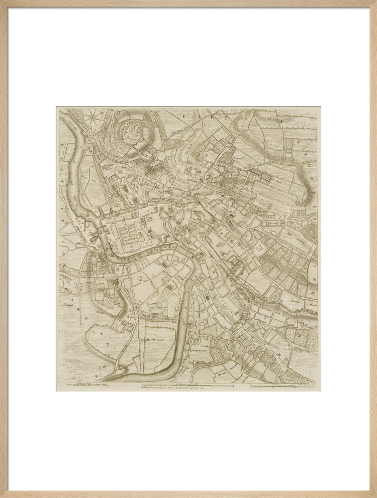
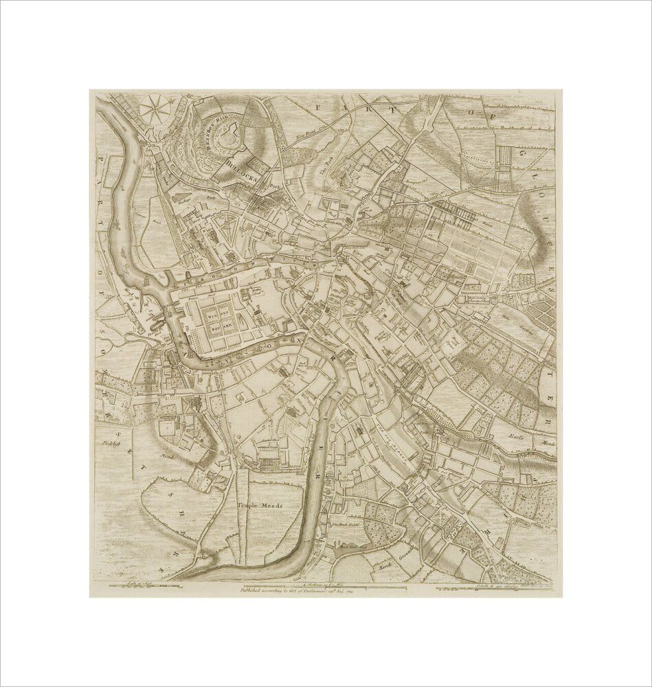
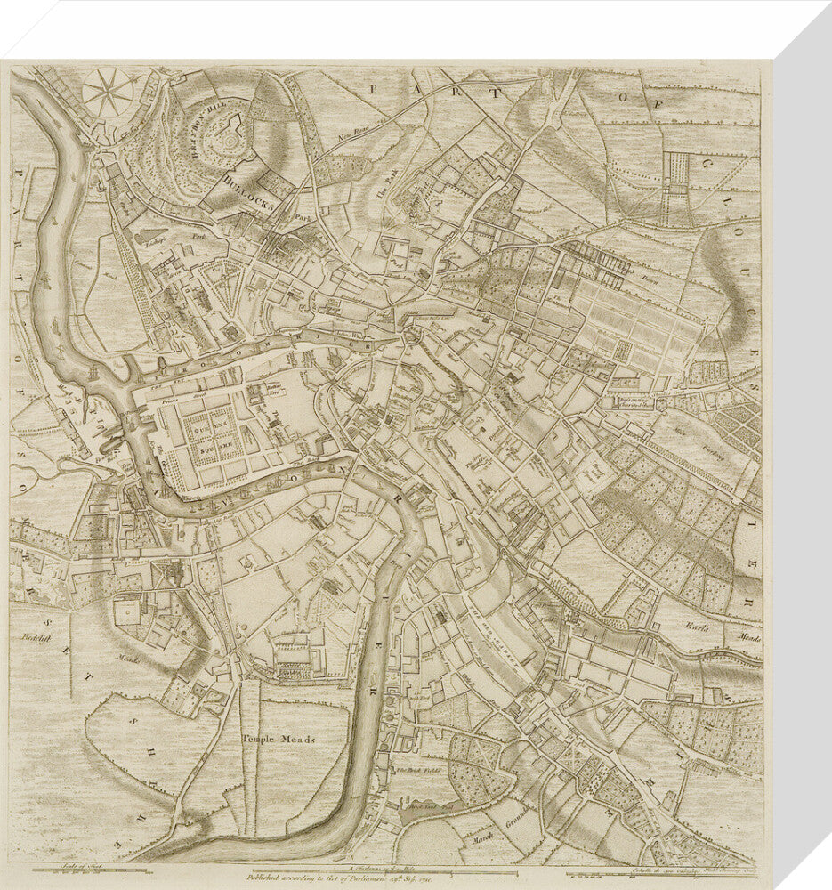
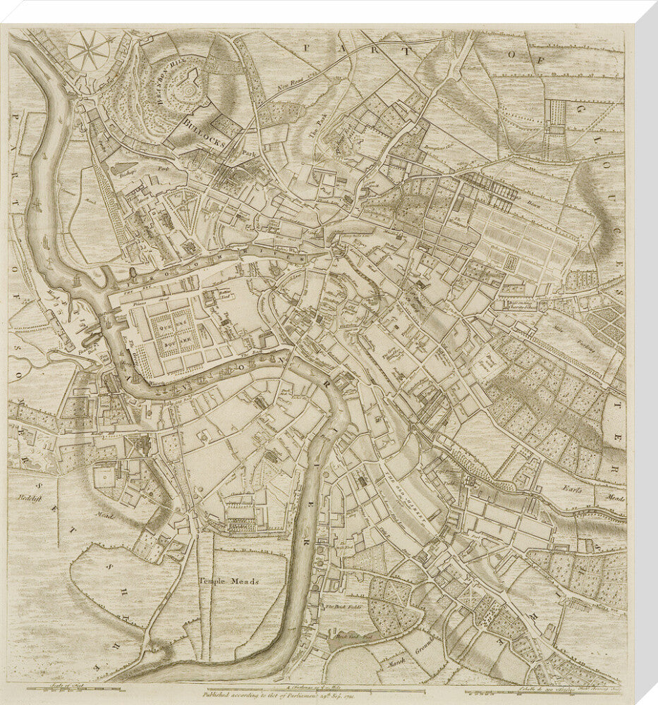
Benning's Bristol Map, 1780: Plan of the City and Suburbs of Bristol
£25.00
Item is in stockHurry! Low inventoryItem is out of stock
Item is unavailable
Benning had been responsible for producing the plates for a number of editions of the small scale Rocque plan. This is rather roughly engraved edition was the last occasion for which Rocque's survey was used as the basis for a new plan of the rapidly growing city. Map, 1780.
Due to the print size these maps are intended for decorative purposes only and are not suitable for study as certain details like street names may be too small to read.
Art Print Sizes:
- Small - 30 x 40 cm
- Medium - 45 x 60 cm
- Large - 60 x 80 cm
- X Large - 75 x 100cm
Stretched Canvas Sizes:
- Small - 36 x 40cm
- Medium - 54 x 60 cm
- Large - 72 x 80 cm
- X Large - 90 x 100 cm
Unstretched Canvas size
- Small - 50 x 54 cm
- Medium - 68 x 74 cm
- Large - 86 x 94 cm
- X Large - 104 x 114 cm
Delivery:
For Custom Prints please allow 5 working days for unframed prints and 15 working days for framed prints/ stretched canvas.
Please note that as Custom Prints are made to order we cannot accept returns
For any further enquiries please email museumretail@bristol.gov.uk
Every purchase you make helps to support Bristol Museums, so thanks for shopping with us!